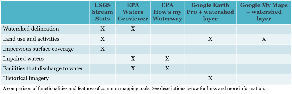
Comparison Mapping Tools Chart
An official website of the State of Georgia.
The .gov means it’s official.
Local, state, and federal government websites often end in .gov. State of Georgia government websites and email systems use “georgia.gov” or “ga.gov” at the end of the address. Before sharing sensitive or personal information, make sure you’re on an official state website.
Still not sure?
Call 1-800-GEORGIA to verify that a website is an official website of the State of Georgia.
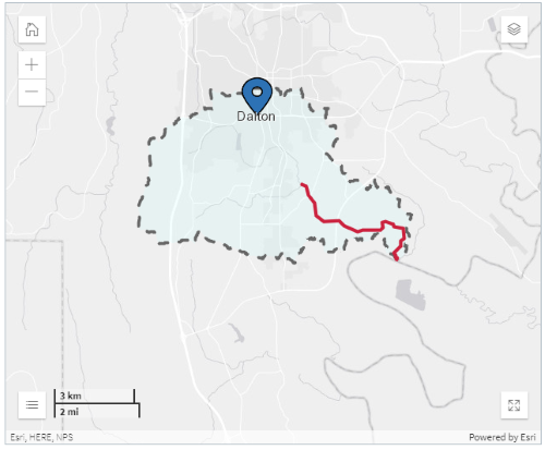
It is important to look beyond your monitoring site and gain a broader understanding of your watershed. The chart and list below serve as a guide to user-friendly mapping applications that can help you delineate your watershed, identify potential and actual pollution sources, and explore historical and present land uses. These helpful tools can also be used to complete the annual Watershed Assessment .
To learn more about these mapping applications, watch the Online Mapping Webinar posted on the AAS YouTube page.
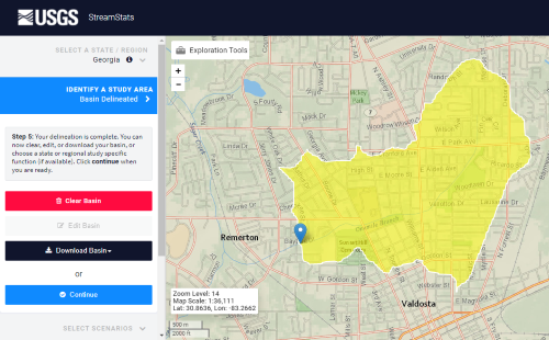
USGS StreamStats - a web-based mapping application that provides basin and streamflow characteristics for a selected point
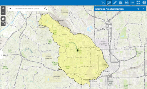
EPA WATERS GeoViewer - a web-based mapping application linked to a variety of water quality datasets; includes an upstream/downstream search for a selected point
EPA How's my Waterway - a mobile compatible web application that provides information about the condition of local waters based on zip code or locality
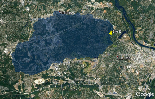
Google Earth Pro - a downloadable desktop application that can import and export GIS data and go back in time with historical imagery
Import GIS data tutorial (e.g. import watershed boundary file from StreamStats into Google Earth Pro)
Save file as .kmz tutorial (e.g. save watershed boundary file in a format that will import into Google My Maps)
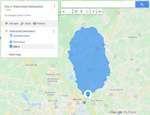
Google My Maps - a desktop and Android mobile application that can import map features and create customizable maps
Import map features tutorial (e.g. import watershed boundary kml file into Google My Maps)
EPA EnviroAtlas Interactive Map - an interactive mapping application that provides ready access to 400+ maps and multiple analysis tools
USGS National Map Advanced Viewer - a mapping application with numerous layers that can be used for many purposes ranging from recreation to scientific analysis
USFWS Wetlands Mapper - a mapping application that provides detailed information on the abundance, characteristics, and distribution of US wetlands
Esri World Imagery Wayback - a digital map archive of world imagery dating back to February 20, 2014
WATERS KMZ (Watershed Assessment, Tracking & Environmental Results System) - a KML file that provides surface water information such as designated use(s) of a waterbody, assessments of water quality, causes and sources of impaired waters, and location of dischargers
Wetlands Data - a KML file of the national wetland inventory, compatible with Google Earth
EPA Enforcement and Compliance History Online (ECHO) - a website used to search for facilities in your community to assess their compliance with environmental regulations
Water Quality Portal (WQP) - the nation's largest source for water quality monitoring data; over 380 million water quality data records from 900 federal, state, tribal and other partners, including GA EPD and Chattahoochee Riverkeeper